Riga Ghetto discrepancies (2014)
By System Admin on Tuesday, November 24 2020, 16:20 - New material - Permalink
As of 2014, it is still remarkable how little the area that was once the Riga ghetto has changed in the seventy years that have passed since the ghetto ceased to exist. A significant number of the houses are no longer standing, and many new structures have been erected, but just as many of the old pre-war houses are still standing and seem to have undergone little or no renovation in more than three quarters of a century. Where houses have collapsed, there sometimes remain piles of rubble as they fell. Many empty lots appear to be returning to a state of nature. Some apartment buildings and schools were built during the Soviet period. The few structures built since 1991, such as the hotel on the corner of Jersikas and Daugavpils streets and the garage on the corner of Virsaišu and Sarkanā Streets, stand out in their spanking newness. The streets retain a distinct feel, and even without knowing what its exact borders were, or even that this was ever a ghetto, the passerby can almost immediately sense something different here.
The only large scale project undertaken to change the face of the neighborhood was probably the disinterment of the old Jewish cemetery in 2011. Until then, it was still possible to see broken bottles and dog refuse scattered amid broken gravestones with legible Hebrew letters on them throughout what had been used as a public park since the end of the war. The place really does look like a normal park now and has been cleaned up a lot. There is a small memorial at the southern corner, at the intersection of Līksnas Street and Ebreju Street (formerly Žīdu Street).
Thus Avraham Shpungin’s two annotated maps and one annotated photo on pages 32-38 remain not only informative as to the neighborhood’s past, but can be used as a practical do-it-yourself walking guide for the ambitious tourist. For those not travelling to Riga, it makes just as helpful a companion for a virtual stroll through the quarter on Google Street View or similar online services.
And it will be at that point that certain inaccuracies will be noticed.
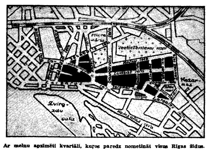
First of all, in Shpungin’s map of the large ghetto, Lazdonas Street is incorrectly placed. This is a short street that runs for only one block between Daugavpils Street and Katoļu Street. Modern maps show it running parallel and to the south of Jēkabpils Street. It runs into Katoļu Street just above the line of Ludzas and Sadovņikova Streets.
Of course, streets sometimes have their courses changed. But a map published by the Nazis at the time of the ghetto’s creation shows these streets to have been configured more or less the same as today. Although the name “Lazdonas” is not marked on this map, it is easy to spot the short Lazdonas Street almost smack in the middle of the map:
Here is Mr. Shpungin’s map, rotated upside down so that it has the same north-south orientation as the above two maps:
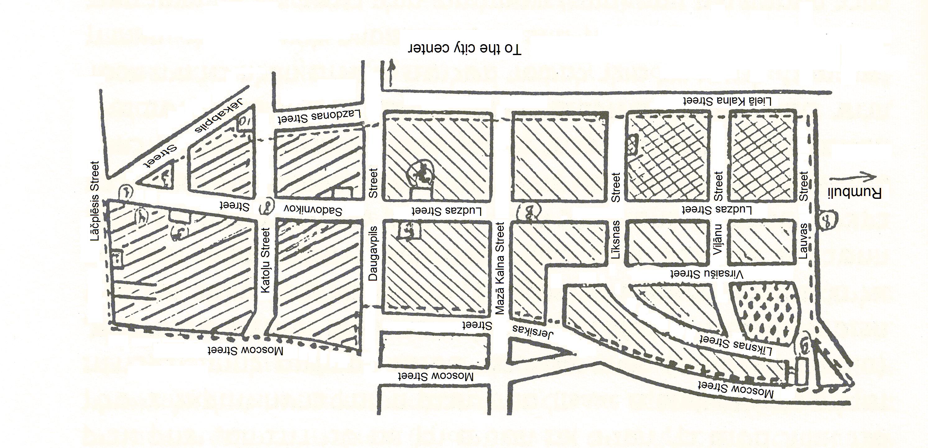
Here, Lazdonas Street is shown running into Katoļu Street farther north, just opposite Jēkabpils Street. Consequently, Jēkabpils Street is shown ending at Katoļu Street, almost as if it is a sort of continuation of Lazdonas Street. The entire western part of the large ghetto is foreshortened in Shpungin’s map, which is not surprising considering that he lived for most of his time there in the small men’s ghetto in the northeast quadrant, which in his map is far more detailed and to scale. Considering that he drew the map fifty years after the fact, and twenty years after leaving Riga, and without access to amenities such as Google Maps or probably any accurate maps of anything in the Soviet Union, such distortions are to be expected.
This brings up the issue of the point on this map that Shpungin has marked as (10) in the southwest crook of Jēkabpils and Katoļu Streets. Shpungin could not have known this corner well or he would not have drawn Lazdonas Street meeting up with Katoļu Street here. He cites this corner as the location of a Catholic Church. Today, it is the site of this apartment building:
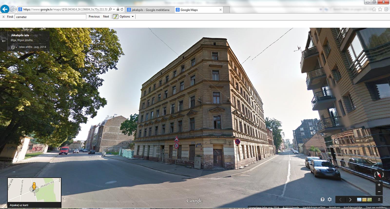
This screenshot from Google Street View is looking south by southwest, with Katoļu Street on the left and Jēkabpils Street on the right. This would have been the northernmost point of the ghetto. What is on the far sides of the two streets would have been outside the ghetto. The building in the middle is clearly pre-war. So there was no Catholic church here at the time.
Of course, Katoļu (“Catholic”) Street has been the site of a Catholic church for centuries, but it is located a block north of here, squarely outside the ghetto. Turning 180° to face north by northeast, we can see its spires:
So it is possible, as Shpungin writes, that through the windows of this church worshippers could see “everything that went on in the ghetto”, at least from some of the upper windows. But it was not located on the same block as the ghetto and it could not have been separated from the ghetto only by a double barbed-wire fence as he implies.
A more interesting conundrum is posed by the placement of the houses on Ludzas Street numbers 35 and 37 as Shpungin marks them on his map of the small men’s ghetto and on the old photo of Ludzas Street. Number 35 is the house that he lived in for most of his time in the ghetto. He mentions that now the number has changed to number 45, indicating that he had visited the spot during his years in Riga following the war. We can surmise that the other house, adjacent on the odd side of the street, is now number 47.
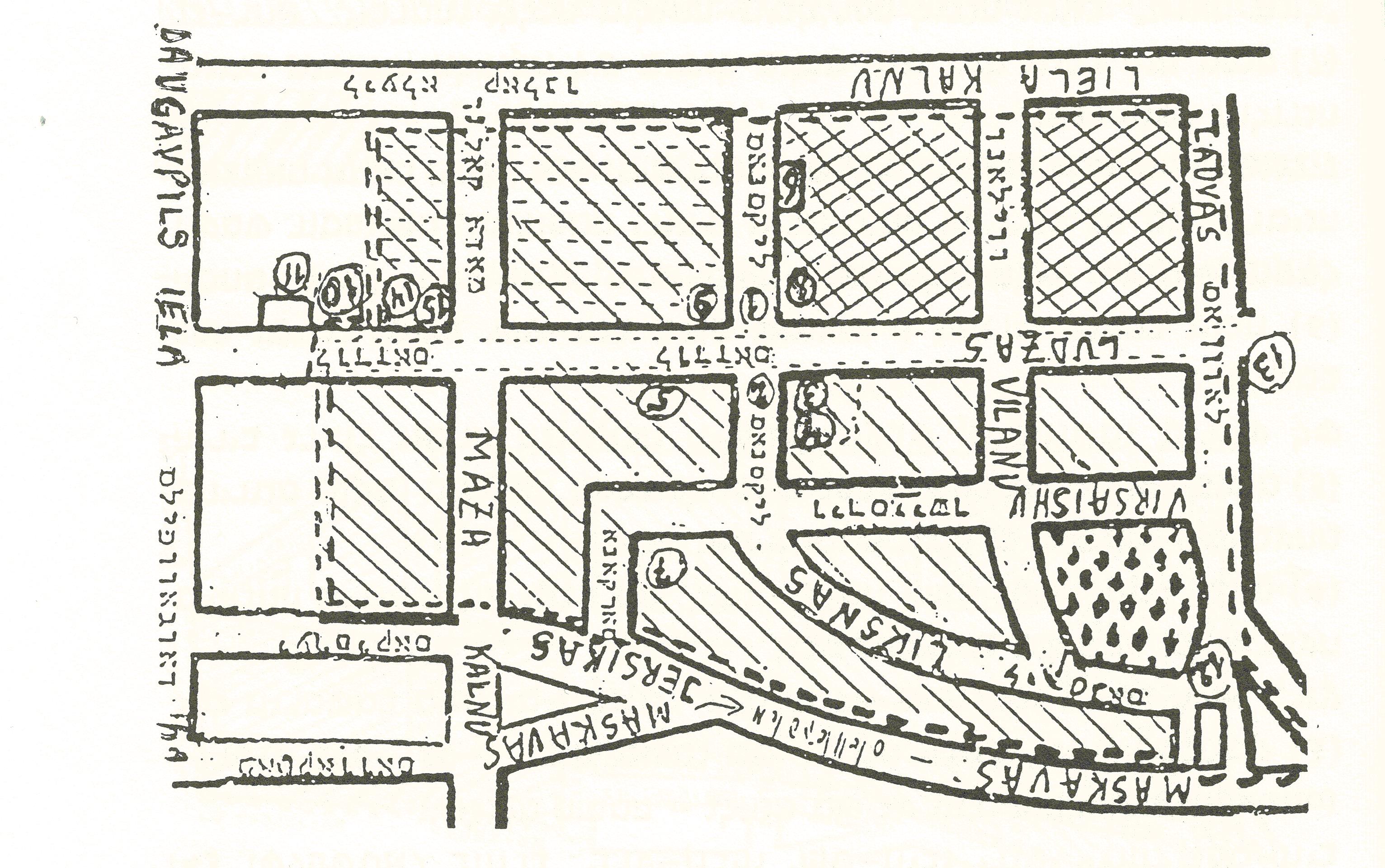
On his map of the small ghetto, Shpungin places these houses on the north side of Ludzas street, which is the odd-numbered side, between the cross streets of Daugavpils and Mazā Kalna. The map is presented here rotated upside down so that it has the same standard north-south orientation as the other maps. Sphungin has used the number (14) to mark the location of the two adjacent houses:
A walk down Ludzas Street in December 2013 finds two obviously pre-war houses numbered 45 and 47 located on the north side of the street on this block. Here is the modern-day number 45:
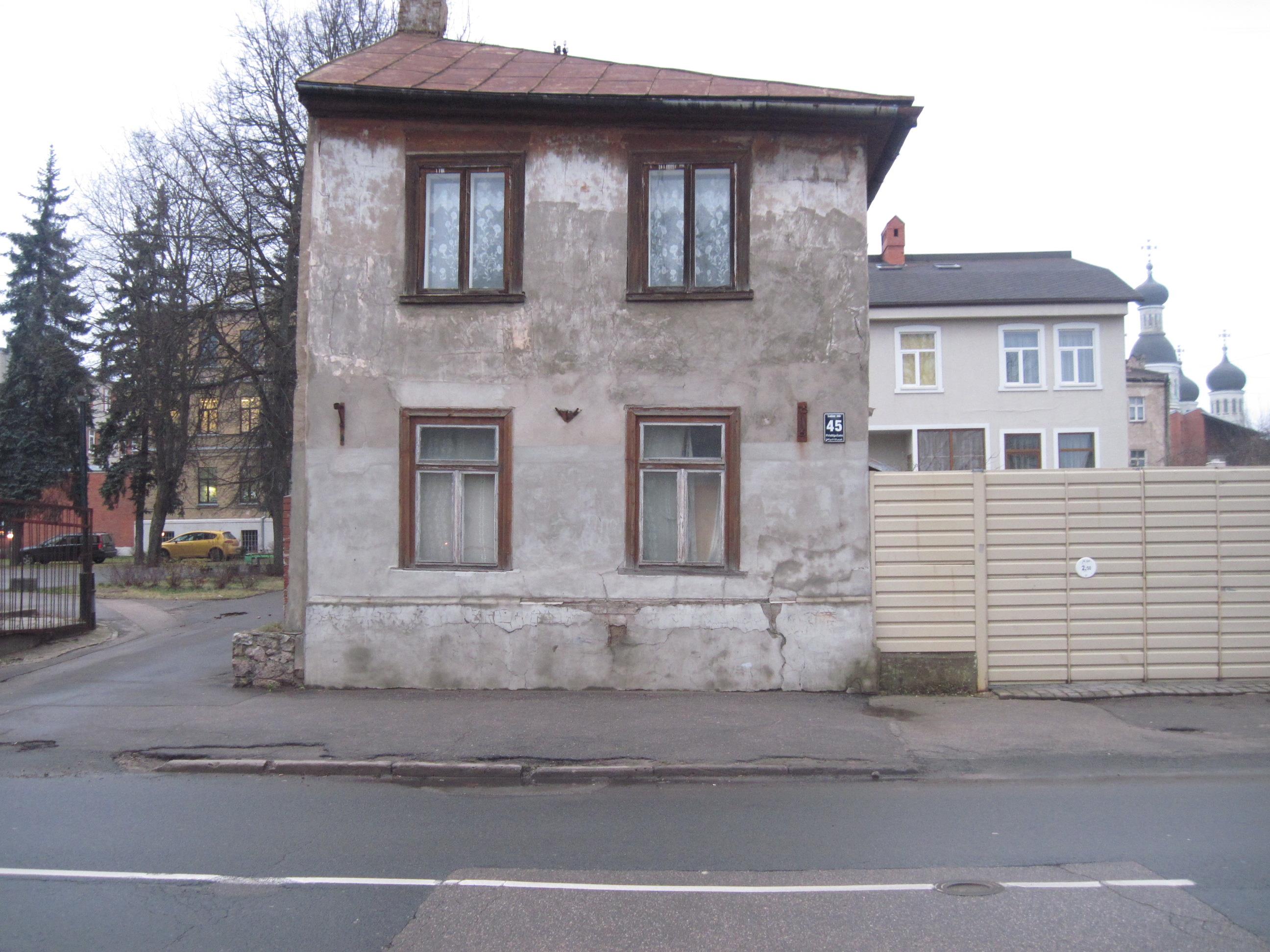
This would have been the old number 35, the house Shpungin lived in as a ghetto inmate “on the second floor, the windows facing the yard”. To the right of the house is a gate of modern construction, the next numbered house is to the right of that. While the neighborhood has many vacant lots today, the fact that the numbering is consecutive across this empty lot between the two houses suggests that the yard is zoned as part of one or both of the two parcels. This would make that empty yard the location of the well where Shpungin spoke with his neighbor Dr. Kretzer as described at the end of the story “The driver of the blue bus”.
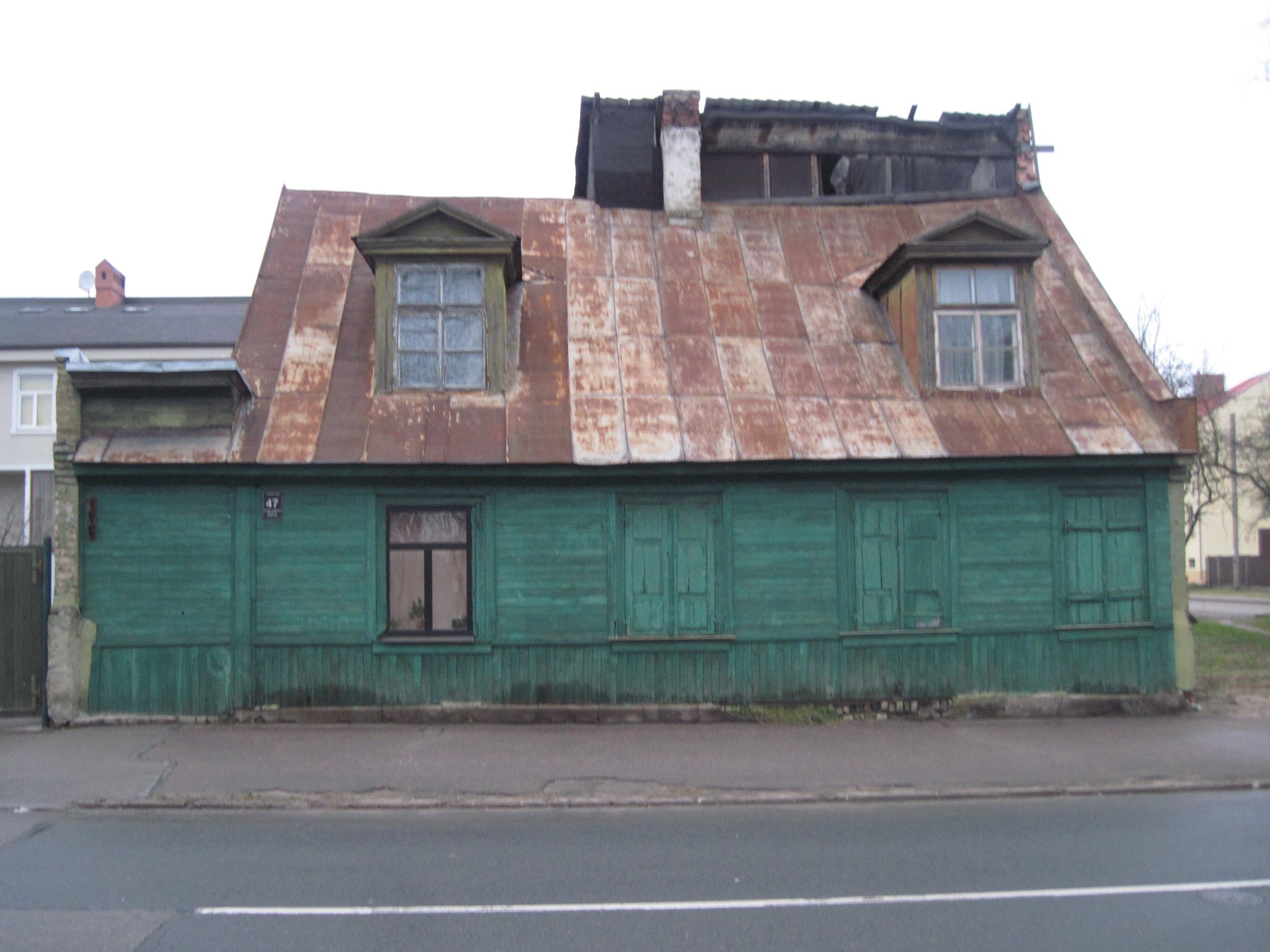
And this is the modern-day Ludzas 47, presumably the old number 37:
Shpungin says these are the same two houses he has marked as (2) and (3) respectively in the annotated photograph:
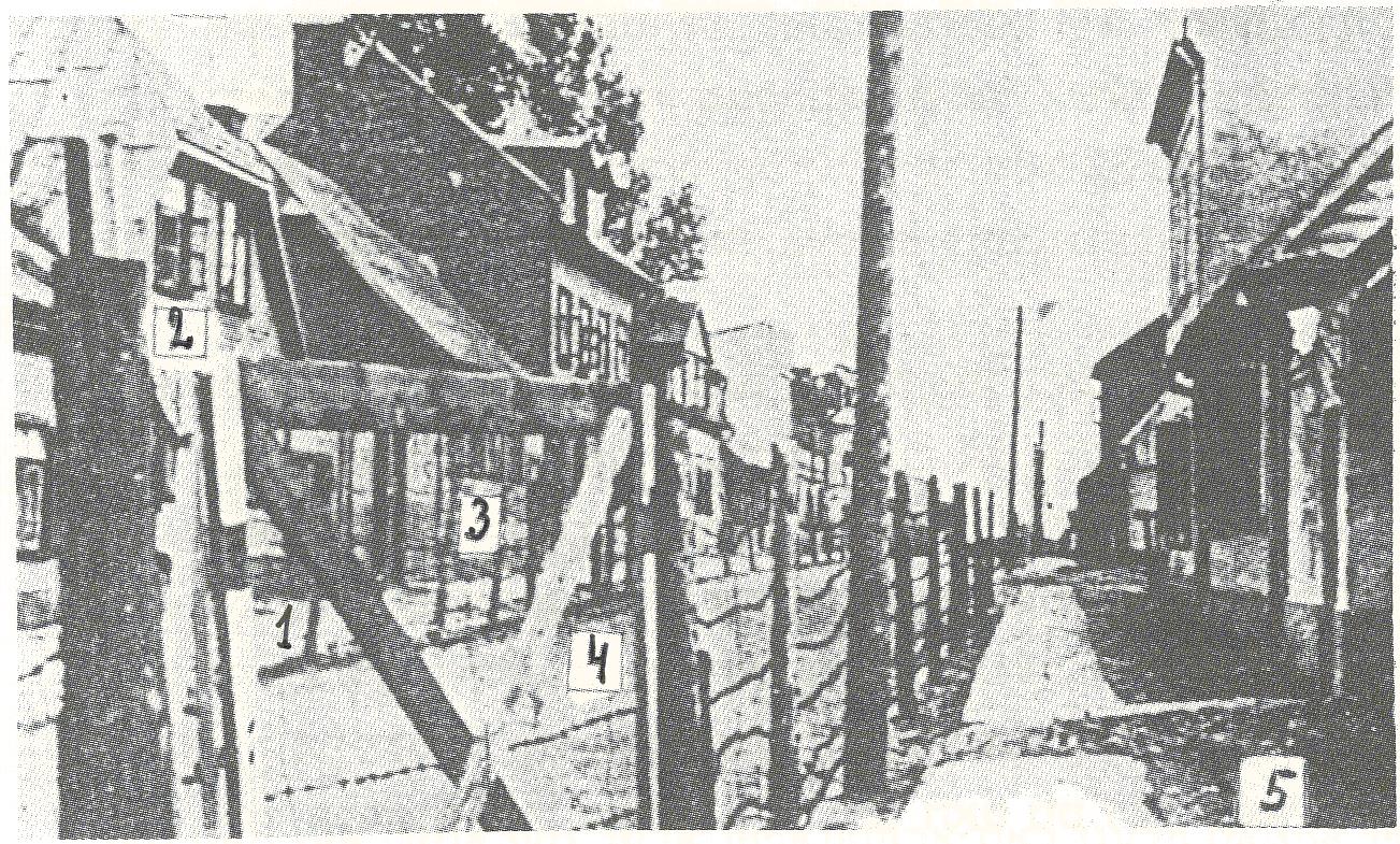
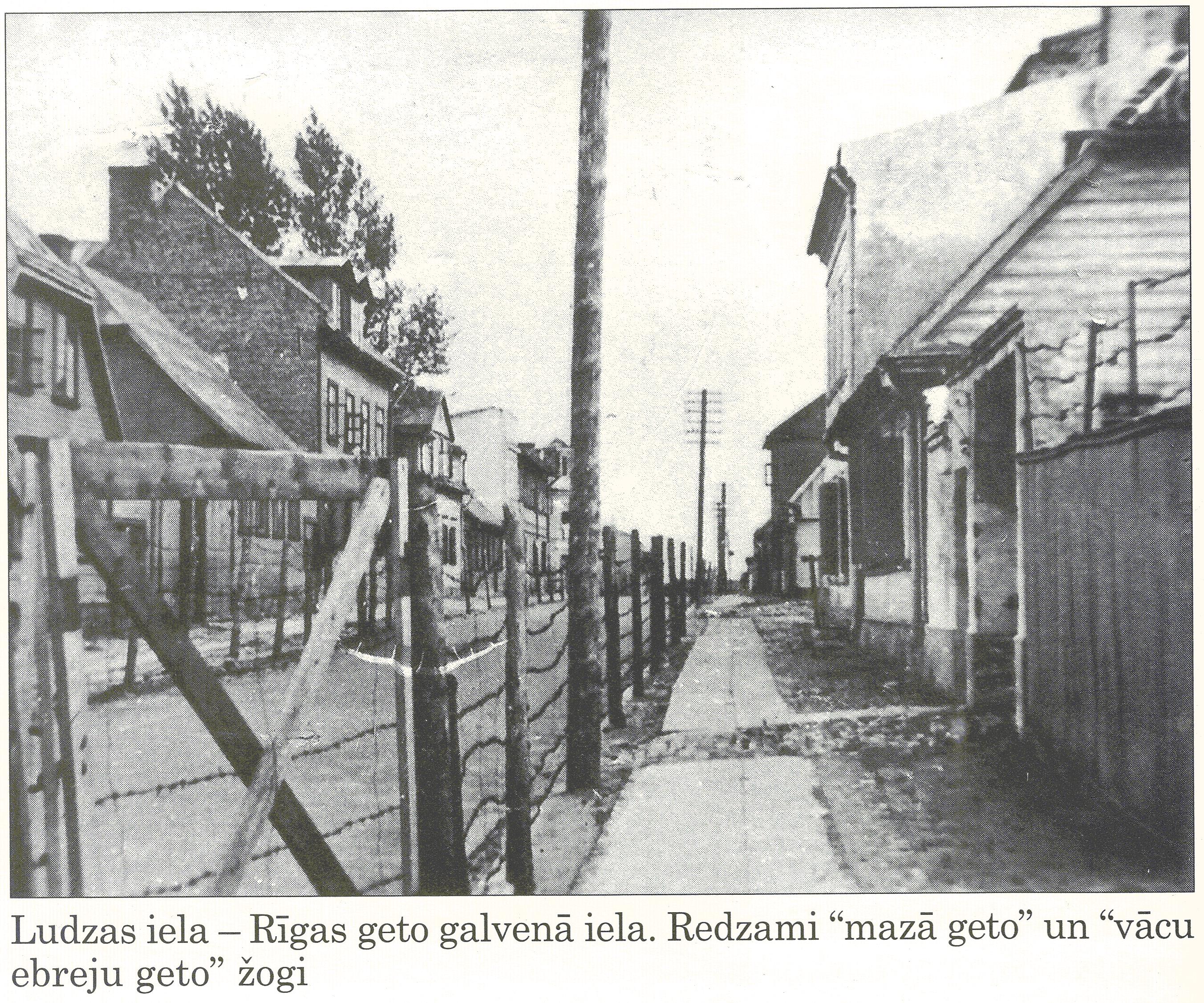
This photograph is in fact one of only a handful of photographs taken of the Riga ghetto during its time of operation. Here is a better quality reproduction:
The house that Shpungin marks as (2) in the photo has a roof that slopes down diagonally on either side, very different than the roof of what today is number 45. The house that Shpungin marks as (3) in the photo has no attic windows facing the street, while the house that is today number 47 has two attic windows protruding towards the street. Of course, it is possible for houses to be modified over a seventy-year period, but the modern-day Ludzas Street numbers 45 and 47 do not look like they have been improved much, if at all, in the intervening years.
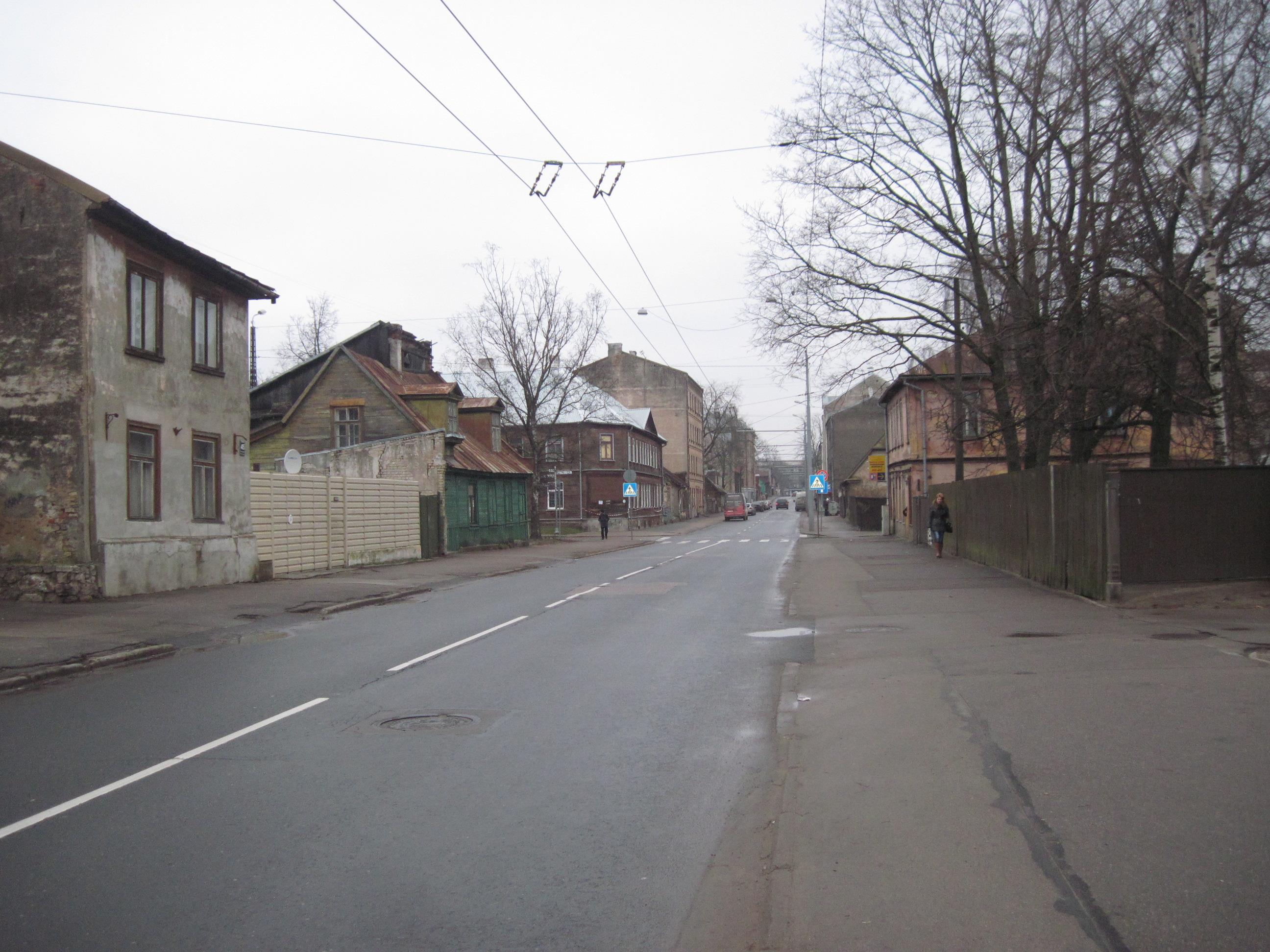
Even more damning is a view of the street looking east down Ludzas Street like in the ghetto-era photo. Numbers 45 and 47 and the modern gate between them are nearest on the left. Even if we assume that several houses have been cleared away on the right side of the street, there is nothing that would identify this as the same block pictured in the war-time photo.
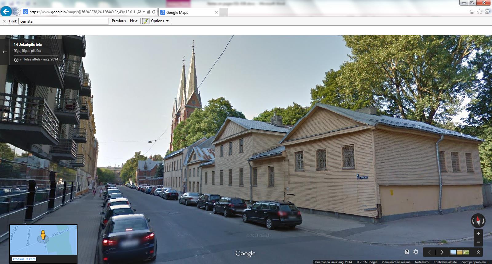
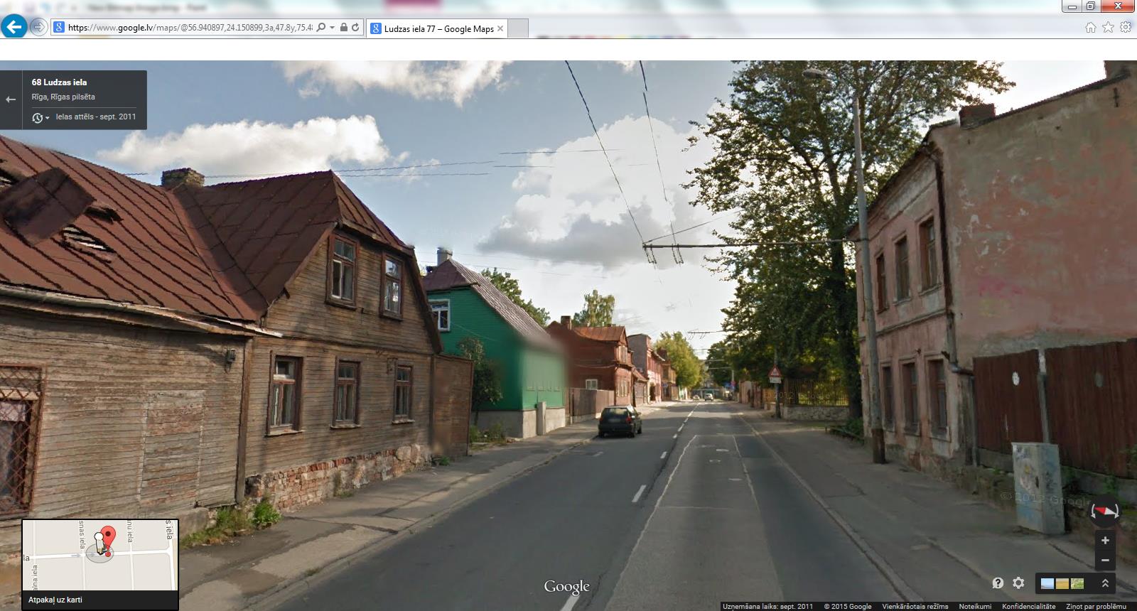
The Riga Ghetto Museum website has archived the known photos of the ghetto and displays them within a map linked to Google Maps. Here is where they place the ghetto-era photo Shpungin has annotated, as viewed in Google Street View August 2014:
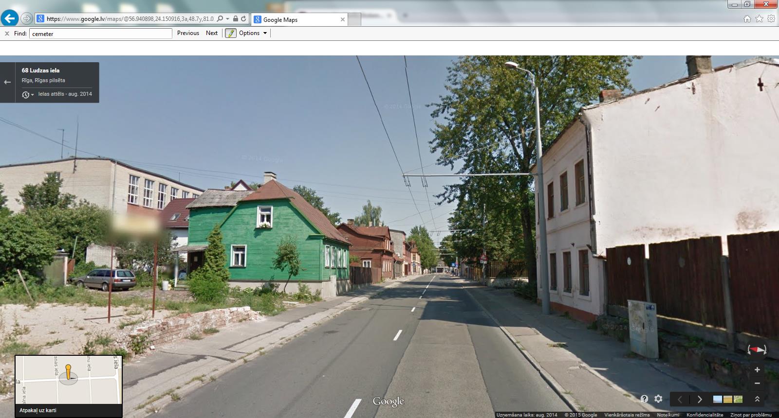
The house on the left-side of the street with the sloping roof and no attic windows streetside is the one Shpungin had marked (3) in the old photo. Compare the side-piece of the roof facing the camera. The house Sphungin had marked (2) would have been in the left foreground, but has been demolished. Repositioning the point-of-view reveals that the sign where it stood reads “land for sale”. It appears the house was pulled down relatively recently as the lot does not have the “back to nature” look seen in other parts of the area. A Soviet-era high school stands on the left, but the other houses in the picture are all pre-war, and like most pre-war houses still standing in the ghetto, have not had much work done on them since the war. Compare the nearest house on the right side, with the same roof cornice and downspout as in the old photo.
Like the old photo, this screenshot is of Ludzas street looking east. But it is not between Daugavpils and Mazā Kalna Streets as Shpugin’s notes would have it, it is in fact three blocks east of there between Līksnas and Viļānu Streets. The number of the house still standing on the left with the sloped roof is Ludzas 77, not Ludzas 47.
Shpungin has given us three layers of data regarding these two houses. He gives their numbers: 35 and 37 which were later changed to 45 and presumably 47. He marks their location on his map of the men’s ghetto, between Daugavpils and Mazā Kalna Streets. And he points out their images in the war-time photo of Ludzas Street. The numbers he gives indeed match the location he gives on the map, but the images he indicates in the photo do not match either the houses at the map location or their numbers.
It seems he remembered the house numbers and location correctly, but misidentified them in the photo, one of the only photos of the ghetto from this period, and perhaps the only one that depicts a block similar to the one he lived on for two years, but not the same one.
Using Google Street View time archiving we can actually retrieve a view from September 2011, before the house Sphungin marked (2) was destroyed:
Sure enough, the roof slopes down diagonally on both sides with two windows on the second floor, just like in the leftmost house in the ghetto-era photo. The brick part of the foundation is the same one visible in the vacant lot in the August 2014 screenshot.